Shawlands and Strathbungo Community Council covers a vibrant area sitting within the boundaries of 3 Glasgow City Council wards; Pollokshields (Ward 6), Langside (Ward 7) and Southside Central (Ward 8)
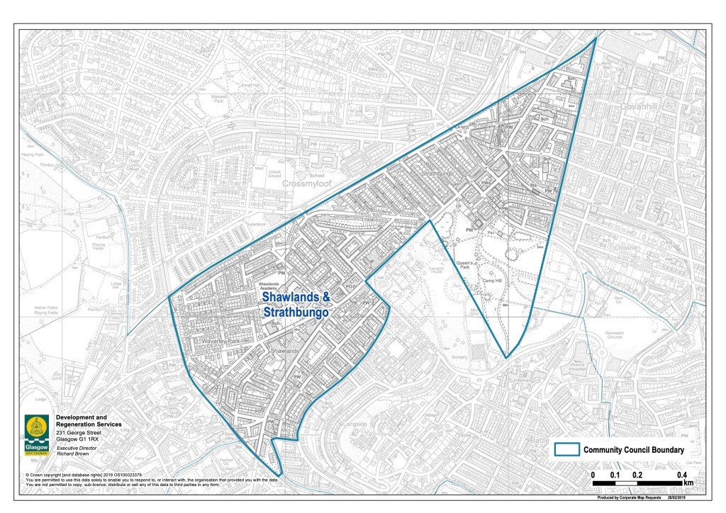
Running from Shawlands train station to where Butterbiggins Road joins Victoria Road, the area includes:
- Shawlands Town Centre
- Strathbungo Shopping area
- The western side of Victoria Road Shopping area
- An area of Queen’s Park including the Arena and part of the boating pond
- 5 schools (Cuthbertson Primary, Hucheson Primary, Shawlands Academy, Shawlands Primary and St Brides)
- 7 places of worship and religious instruction
- 2 conservation areas (Shawlands Cross and Strathbungo)
You can access a Google map of the area here
You can use Glasgow City Council’s ‘Near Me’ map to find more details related to your location

You must be logged in to post a comment.